Federal Emergency Management Agency (FEMA) has released draft versions of updated flood maps that could alter flood insurance requirements for homeowners in certain communities.
The FEMA Flood Map Service Center (MSC) is the official public source for flood hazard information produced in support of the National Flood Insurance Program (NFIP).
Use the MSC to find your official flood map, access a range of other flood hazard products, and take advantage of tools for better understanding flood risk.
FEMA flood maps are continually updated through a variety of processes. Effective information that you download or print from this site may change or become superseded by new maps over time.
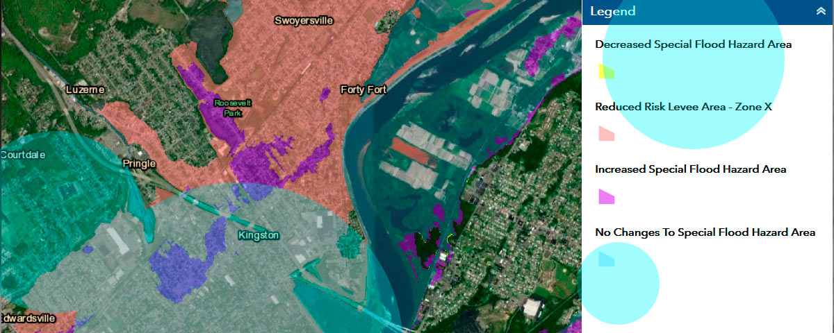
The updated maps, referred to as Pending Flood Insurance Rate Map databases, have been designated final through a Letter of Final Determination.
Although considered final, they will not take effect for six months.
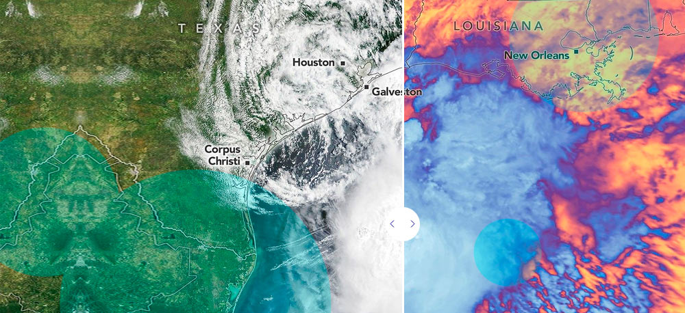
Floods occur naturally and can happen almost anywhere. They may not even be near a body of water, although river and coastal flooding are two of the most common types. Heavy rains, poor drainage, and even nearby construction projects can put you at risk for flood damage.
Flood maps are one tool that communities use to know which areas have the highest risk of flooding.
This six-month period provides residents and property owners with time to review the revised flood hazard data and assess how potential changes may affect their properties.
Once the maps become effective, they will determine which properties are subject to mandatory flood insurance requirements, particularly for homes located in high-risk flood zones.
Homeowners are encouraged to examine the updated maps carefully and consult their local floodplain manager to understand how the changes could influence development plans, property values and insurance costs.
Flood maps help mortgage lenders determine insurance requirements and help communities develop strategies for reducing their risk.
The mapping process helps you and your community understand your flood risk and make more informed decisions about how to reduce or manage your risk.
Updates to flood maps are a collaboration between your community and FEMA.
Every community that participates in the National Flood Insurance Program has a floodplain administrator who works with FEMA during the mapping process.
FEMA provides the technology and relies on your community’s leaders to share local knowledge and plans to make the maps as accurate as possible.
- FEMA and the floodplain administrator work with local engineers and surveyors to collect the data to inform the maps.
- Community members are also invited to provide information to help local officials better understand how water drains in the area.
- FEMA works with local experts before combining the data into a computer model that is used to create the updated flood map.
Once the data analysis is done, preliminary flood maps will be available for review. Before your community decides to adopt the maps, you have 90 days to submit technical data to support an appeal to the map.