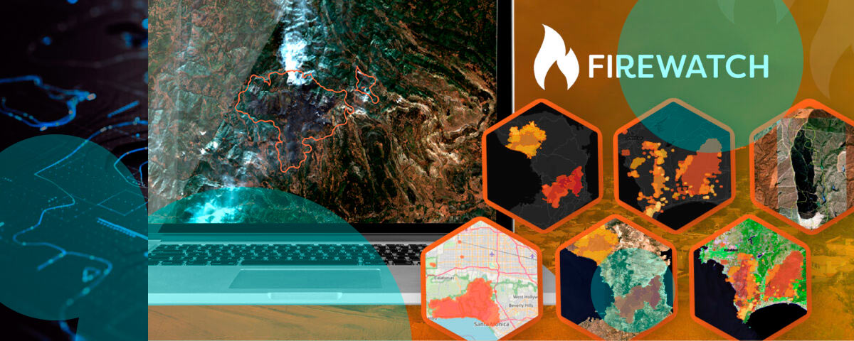
Geospatial Insight, a cloud-based risk and climate intelligence provider, has launched FireWatch, a wildfire prediction and monitoring platform built to combine live satellite analysis, environmental data, and weather forecasts into near real-time intelligence.
The system is aimed at insurers, emergency services, governments, and utility companies that need faster decisions before, during, and after wildfire events. The pitch is simple enough. Better signal, earlier action, lower losses.
Available through an API, FireWatch gives users a baseline wildfire risk layer for identifying and tracking exposure across sectors, including insurers managing higher-risk portfolios.
For live fire tracking and post-event analysis, the platform pulls in multiple data sources, including thermal satellites, high-resolution weather models, soil moisture data, historical fire records, and optional high-resolution imagery.
Data refreshes up to four times a day. That gives users a faster read on changing conditions, active developments, and likely impact. In wildfire work, lag hurts.
Paul Fearn, chief executive at Geospatial Insight, said FireWatch gives organisations the intelligence needed to act decisively before, during, and after wildfire events. He said the product combines Earth Observation data with environmental insight to change how wildfire risk is understood and managed.
FireWatch is built for a wide range of uses. Insurers can apply it to underwriting and claims. Emergency teams can use it to guide deployment. Governments can feed it into resilience planning.
Utilities can use it to protect exposed infrastructure. Reinsurers can use it to watch portfolio accumulation and event development as conditions shift.
The platform is designed to issue earlier warnings, track live events, and provide trend analysis over time. That helps reduce damage, improve response planning, support evidence-led policy decisions, and strengthen day-to-day operational readiness.
With wildfires rising in frequency and severity across many regions, FireWatch is positioned as a practical tool for protecting people, property, and the environment.
Geospatial Insight focuses on risk and climate intelligence through cloud-based services built to help organisations understand environmental exposure.
The company says it combines global imagery access with advanced data analysis to support decision-making across insurance, risk management, and related markets. FireWatch is its latest product, built for cost-effective wildfire monitoring across large areas.