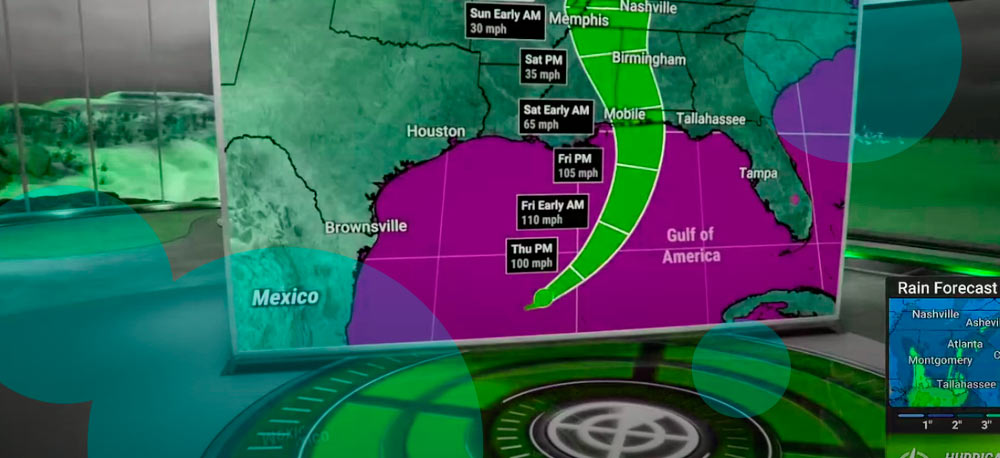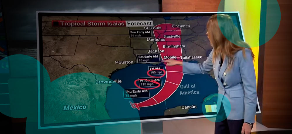
- Hurricane Isaias has strengthened into a Category 3 storm with sustained winds of 120 mph and is forecast to make landfall near Pensacola, Florida, on October 9.
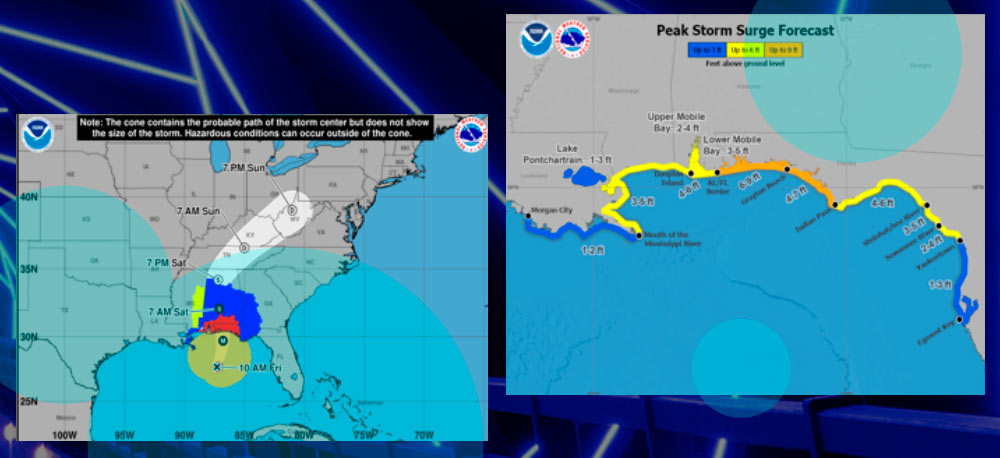
- Coastal communities face storm surge of up to 9 feet, rainfall reaching 15 inches, tornadoes and widespread power outages. Mandatory evacuations are underway.
- Hurricane-force winds could extend 100 miles inland into Alabama, while parts of Georgia, including Atlanta, may experience gusts of 55 mph or higher.
Hurricane Isaias strengthened into a Category 3 major hurricane on Friday, October 9, 2026, as it approached the northern Gulf Coast, prompting mandatory evacuations, emergency declarations and preparations for damaging winds and coastal flooding.
The National Hurricane Center (NHC) reported sustained winds of 120 mph, with the storm expected to make landfall Friday night near Pensacola, Florida. The latest forecast indicates Isaias could maintain Category 3 intensity as it reaches the coast, rather than weakening to Category 2 as previously anticipated.
At 11 a.m. Central Time, the hurricane was approximately 180 miles south of Pensacola. The NHC began issuing hourly updates on its position and intensity as the storm approached land.
Authorities warned of storm surge reaching 9 feet, rainfall totals of up to 15 inches and tornadoes that could develop with little warning. Widespread electricity outages are expected across affected coastal and inland areas.
States of emergency have been declared in parts of Florida, Alabama and Georgia, while mandatory evacuation orders have been issued for several coastal counties.
Florida officials urged residents in evacuation zones to leave before conditions deteriorate, particularly in areas exposed to dangerous storm surge. Thousands of people in designated evacuation zones in Escambia County were reportedly choosing to remain in their homes.
Hurricane-force winds could reach 100 miles inland
The stronger landfall forecast has increased the potential for wind damage beyond Florida’s coastline, particularly across Alabama and Georgia.
According to the NHC, sustained hurricane-force winds of at least 74 mph could extend as far as 100 miles inland into southern Alabama, threatening infrastructure and electricity supplies.
“Gusts to hurricane force could extend even farther north into central Alabama,” the hurricane center said.
In Georgia, damaging winds are expected to reach areas farther inland, with Atlanta potentially experiencing gusts of 55 mph or slightly higher on Saturday.
Although Isaias is forecast to weaken after landfall, its wind field could continue to cause damage and prolonged electricity disruptions well beyond the immediate coastal impact zone.
Florida prepares bridge closures and transport disruptions
Authorities in Escambia County, Florida, are preparing to close three major bridges when winds reach 40 mph or conditions become unsafe, Sheriff Chip Simmons told CNN.
The affected crossings include Theo Baars Bridge between Perdido Key and the mainland, Pensacola Bay Bridge connecting Pensacola and Gulf Breeze, and Bob Sikes Bridge between Gulf Breeze and Pensacola Beach.
County schools and district offices have already closed as residents prepare for the storm.
The Emerald Coast Utilities Authority also announced that water and sewer services on Pensacola Beach would be temporarily suspended at 3 p.m. Central Time on Friday, after emergency responders evacuated the island.
Several Florida airports are scheduled to close ahead of the hurricane, while Amtrak rail services in parts of Louisiana and Alabama have been disrupted.
Emergency officials continue to warn residents against remaining in mandatory evacuation zones as Isaias approaches the coast. The main threats include dangerous storm surge, hurricane-force winds, flash flooding and tornadoes, with damaging conditions expected to spread inland through Saturday.