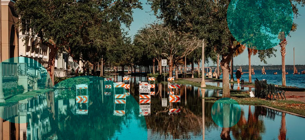
Florida faces another stretch of heavy rain, coastal flooding and dangerous beach conditions as a stalled front keeps much of the state unusually wet.
Northern Florida has taken some of the hardest hits. Parts of the Panhandle recorded close to a foot of rain during the past week, while areas from Gainesville to Jacksonville received roughly 4–6 inches. More rain remains in the forecast, increasing flooding concerns in places where soils and drainage systems are already saturated.
Northeastern Florida also faces a separate coastal flooding problem. Persistent onshore winds combined with high astronomical tides are pushing water into the Atlantic coast, Intracoastal Waterway and St. Johns River basin.
The National Weather Service in Jacksonville has a Coastal Flood Warning in effect for parts of the St. Johns River basin through 5 p.m. Thursday, Oct. 8. A Coastal Flood Advisory follows through 2 p.m. Saturday. Along coastal Duval County, the advisory also remains in force through Saturday afternoon, with a high rip current risk continuing through late Saturday night.
Minor tidal flooding is expected along portions of the Atlantic shoreline. Water levels around the St. Johns River remain more concerning, with local moderate flooding possible as persistent northeast winds keep water from draining efficiently.
A slow-moving cold front that earlier produced flooding across parts of the Southwest and Southern Plains has stalled over Florida. Moisture continues to collect around the boundary, producing repeated showers and thunderstorms from the Panhandle into Central Florida.
Several additional inches of rain are possible in the wettest areas before the pattern starts changing. Local totals become more difficult to predict where thunderstorms repeatedly move over the same locations.
Jacksonville is among the cities dealing with both rainfall and coastal effects. The National Weather Service expects showers, with thunderstorms possible during the afternoon. Northeast winds also remain persistent near the coast.
Some locations in North Florida have already received enough rain to approach or exceed normal October totals within a single week.
Flooding risk isn’t distributed evenly across the state. Florida’s sandy soils absorb significant rainfall, and much of its terrain is flat. In practice, the more immediate flash flood problems tend to develop in cities, low-lying neighborhoods and areas with poor drainage.
Central Florida is dealing with its own round of wet weather. Showers are moving through the region, with heavier downpours and thunderstorms expected during the afternoon.
Sumter County remains under a flood watch. Other parts of Central Florida aren’t currently included, though additional flooding remains possible where Wednesday’s rain left standing water or saturated ground.
The stalled frontal boundary is responsible for much of the repeated rainfall. It is expected to lose some influence by Friday as high pressure returns and winds shift toward a more typical easterly flow.
North Florida’s coastal low developed offshore from northeastern Florida earlier in the week. Combined with high pressure farther north, the system tightened the pressure difference along the Southeast coast and strengthened onshore winds.
The setup raised the risk of beach erosion, coastal flooding and dangerous rip currents from northern Florida into Georgia and South Carolina.
Earlier forecasts called for coastal wind gusts near 35–40 mph in exposed locations. Charleston, Savannah and Jacksonville were among the cities positioned closest to the strongest coastal effects.
Dangerous rip currents are expected along the northeast Florida coast through late Saturday night. The NWS warns that strong rip currents are capable of pulling swimmers away from shore into deeper water.
Coastal flooding is another issue because of the St. Johns River’s geography. The river is shallow and strongly influenced by tides, leaving water levels sensitive to sustained onshore winds and higher tides.
Persistent northeast flow has pushed water into the basin. That process slows drainage and raises river levels even when rainfall at a specific location isn’t extreme.
The NWS said coastal flooding around Jacksonville includes flooded roads, parks and low-lying lots, with isolated road closures possible. More significant flooding has been expected in portions of the St. Johns River basin.