An exceptionally strong El Niño is developing across the tropical Pacific, with the potential to influence weather worldwide during winter 2026-27. Rising ocean temperatures are already affecting atmospheric circulation, tropical storm activity and regional precipitation patterns, while an unusually early disruption of the polar vortex introduces uncertainty about the arrival of colder weather.
The event has reached record strength by some measures, although the National Oceanic and Atmospheric Administration (NOAA) had not yet formally classified it as a Super El Niño ahead of its November 12 update.
- The 2026 El Niño has reached exceptional strength, with Pacific Ocean temperatures approaching the threshold for a Super El Niño that could persist into spring 2027.
- NOAA’s winter 2026-27 outlook favors above-average temperatures across the northern United States and a wetter southern storm track, increasing rainfall and flooding risks in California and the Southeast.
- An unusually early polar vortex disruption could bring colder conditions to eastern North America and northern Europe in late November or December, although its interaction with El Niño remains uncertain.
Forecasters expect the phenomenon to remain influential through winter before potentially giving way to La Niña conditions in spring 2027.
The competing atmospheric signals complicate seasonal predictions. El Niño generally favors warmer conditions across the northern United States and increased storm activity farther south. A weakened polar vortex, meanwhile, can allow Arctic air to move into populated regions of North America and Europe.
Scientists caution that neither pattern determines local weather on its own. Seasonal outlooks describe the probability of broad temperature and precipitation trends rather than specific storms or cold outbreaks.
What makes the 2026 El Niño unusually strong?
El Niño is a recurring climate phenomenon associated with unusually warm surface waters in the central and eastern equatorial Pacific Ocean. It typically develops every three to five years, lasts approximately nine to 12 months and influences weather patterns far beyond the Pacific basin.
Relatively modest changes in ocean temperatures can produce substantial atmospheric effects because water stores far more heat than air.
The additional ocean heat alters tropical rainfall, atmospheric pressure and the position of major jet streams. Those changes can affect drought, flooding, temperature extremes and tropical cyclone development across multiple continents.
A Super El Niño is generally associated with sea surface temperature anomalies of at least 2 degrees Celsius in the equatorial Pacific over a sustained three-month period.
NOAA’s Climate Prediction Center found that temperatures during July-September 2026 had not met that threshold. However, the August-October average was expected to qualify, potentially allowing a formal Super El Niño declaration in November.
The event could continue intensifying before reaching its peak toward the end of 2026 or in early 2027.
Scientists are still investigating how global warming influences the frequency and intensity of El Niño events. Some research suggests that rising global temperatures may strengthen extreme episodes, although the relationship remains an active area of climate research.
Super El Niño could intensify global weather extremes
The influence of El Niño extends beyond seasonal temperature changes. By redistributing heat across the atmosphere, the phenomenon can alter precipitation patterns and increase exposure to extreme weather in vulnerable regions.
Parts of the Amazon rainforest are already experiencing severe drought, with associated increases in wildfire risk. Other regions, including the Greater Horn of Africa, face unusually heavy rainfall and flooding.
Research examining the health consequences of additional heat associated with the current event has estimated that approximately 450,000 people worldwide could face an increased risk of heat-related mortality. This is a modeled estimate of potential impacts, not a confirmed death toll or a certain outcome.
The magnitude of regional effects depends on local climate conditions, infrastructure, population exposure and other atmospheric influences.
For the United States, the principal winter pattern associated with strong El Niño events typically involves an active southern jet stream, bringing more storms across the southern states, and comparatively milder conditions farther north.
The unusually early polar vortex disturbance means this winter may not follow the typical pattern throughout the season.
NOAA winter 2026-27 forecast favors a warm North and wetter South
NOAA’s Climate Prediction Center expects above-average temperatures across much of the northern United States between December 2026 and February 2027.
The strongest warm signals extend across portions of the Midwest, Northeast, northern Great Plains and Pacific Northwest.
The southern United States faces greater uncertainty in temperatures but increased potential for precipitation as the Pacific jet stream directs storms across the region.
Regional projections include:
| US region | Winter 2026-27 outlook |
|---|---|
| Alaska | Milder conditions favored along the Gulf Coast, with greater uncertainty in western areas |
| Pacific Northwest | Above-average temperatures favored in Washington, northern Oregon and northern Idaho |
| California | Warmer conditions favored along the coast and in northern areas, with increased southern storm potential |
| Southwest | Mixed temperature signals, with an active southern storm track |
| Northern Great Plains | Above-average temperatures favored, particularly in Montana and North Dakota |
| Midwest | Warmer-than-average conditions favored in Minnesota, Wisconsin and Michigan |
| Northeast | Above-average temperatures favored from Pennsylvania toward Maine |
| Southern Great Plains | Warmth favored in Kansas and eastern Oklahoma, with greater uncertainty in Texas |
| Southeast | Increased storm potential, with temperatures varying across the region |
| Hawaii | No clear preference for above- or below-average temperatures |
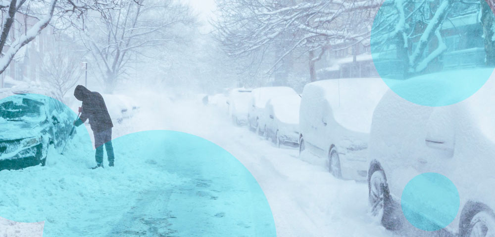
These probabilities do not exclude brief periods of severe cold or heavy snow. An individual region can experience several winter storms and still finish the season warmer than its historical average.
California and the southern US face increased storm risks
California is among the states most exposed to changes in Pacific storm activity during strong El Niño winters.
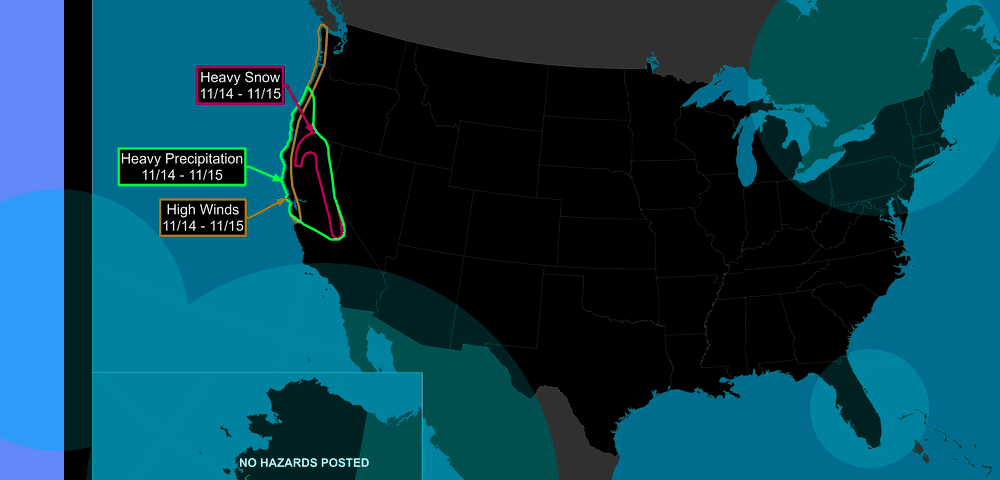
An extended and more active Pacific jet stream can direct moisture-rich systems toward the West Coast, increasing the potential for heavy rainfall, flooding and mountain snowfall.
Southern California faces particular concern because intense storms can produce substantial rainfall over short periods, even when the broader seasonal temperature outlook is relatively mild.
The same atmospheric circulation can carry storms eastward across Arizona, New Mexico, Texas and the Gulf Coast before reaching the Southeast.
NOAA’s winter outlook favors increased storm activity across portions of the southern United States, potentially extending from Southern California to Florida.
More frequent precipitation could help relieve drought in some areas but also increase flood exposure where heavy rain overwhelms drainage systems or falls on already saturated ground.
The southeastern United States may experience temperatures closer to seasonal averages, although individual cold outbreaks remain possible. The location and intensity of specific storms cannot be reliably established months in advance.
Midwest, Northeast and northern states may experience a milder winter
Strong El Niño events frequently reduce the likelihood of prolonged cold across the northern United States by shifting atmospheric circulation patterns.
The 2026-27 seasonal outlook favors above-average temperatures across much of the Midwest, Great Lakes and Northeast.
Minnesota, Wisconsin and Michigan show particularly strong signals for a warmer winter. Similar conditions are favored across portions of the northern Great Plains, including northwestern Montana and eastern North Dakota.
From Pennsylvania toward Maine, NOAA also favors warmer-than-normal seasonal temperatures. These conditions could result in fewer sustained cold periods and, in some locations, a greater proportion of winter precipitation falling as rain rather than snow.
Snowfall outcomes remain less certain because warmer average temperatures do not necessarily eliminate major snowstorms.
Short periods of favorable atmospheric conditions can still produce substantial snowfall, particularly around the Great Lakes and in the Northeast.
The possibility of polar vortex disruptions increases uncertainty about the timing and intensity of such events.
Alaska could face warmer temperatures and reduced snowfall
Alaska is particularly sensitive to additional warming because Arctic temperatures are already increasing several times faster than the global average.
A strong El Niño can reinforce the Aleutian Low, a large area of atmospheric low pressure over the North Pacific that influences storm tracks and temperatures across Alaska.
The resulting effects depend on the strength and location of the pressure system, which are also influenced by atmospheric conditions unrelated to El Niño.
Historical evidence indicates that populated areas along the Gulf of Alaska and in southeastern Alaska may experience milder winter conditions.
Warmer temperatures can also increase the likelihood of precipitation falling as rain rather than snow.
According to the National Weather Service, most previous strong El Niño winters produced below-average snowfall across Alaska.
The potential effects would add to existing climate pressures, including sea ice loss, coastal erosion, permafrost thaw, harmful algal blooms and changing fish distributions.
These environmental changes have consequences for infrastructure and communities, particularly Native Alaskan populations that depend on marine ecosystems and traditional food sources.
Polar vortex disruption arrives unusually early
Another major development is taking place in the stratosphere above the Arctic.
The polar vortex, a circulation of strong winds that forms around the North Pole during autumn and winter, has weakened dramatically in an exceptionally early sudden stratospheric warming event.
The polar vortex generally helps contain very cold Arctic air at high latitudes. When the circulation weakens or reverses, atmospheric changes can sometimes increase the likelihood of cold air moving south.
Major sudden stratospheric warming events typically occur between January and March. The previous earliest documented events occurred on November 28 in 1968 and 2025, making the current November 2026 disruption unusually early.
Research has suggested that El Niño may sometimes contribute to a weaker polar vortex and increase the frequency of major stratospheric disturbances, but the relationship is not sufficiently understood to establish whether it caused the current event.
The unusual timing also limits the usefulness of comparisons with previous events because the historical record contains few closely comparable examples.
Arctic cold reaches the US and Europe as forecasts turn uncertain
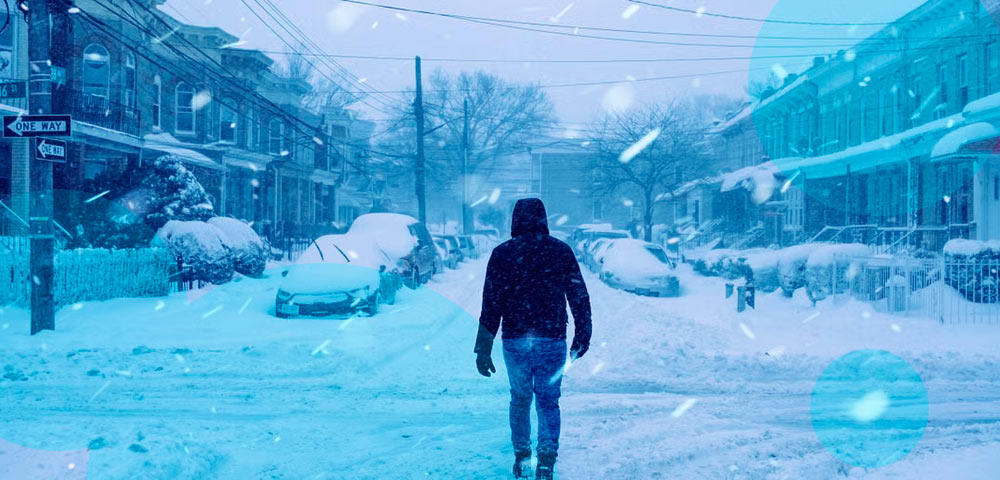
A significant outbreak of colder air has already spread across North America and Europe during the second week of November.
Temperatures across much of the eastern United States are forecast to fall approximately 7-14 degrees Fahrenheit below typical mid-November levels, with the coldest conditions expected around November 12-13.
Much of the area east of the Mississippi River could experience its lowest temperatures since spring, including the first widespread frosts of the season.
Northern and northwestern Europe are also experiencing colder conditions following an unusually mild autumn in several areas.
The immediate cold spell is not expected to persist for an extended period.
Forecasts indicate that above-average temperatures could return to the eastern United States and other affected regions during the following week.
The current outbreak may also precede more substantial changes associated with the stratospheric disruption.
That places late November and early December within the period when eastern North America and northern Europe could face an increased risk of colder conditions.
The current cold outbreak should not automatically be attributed to the polar vortex event, since the connection between stratospheric changes and surface weather can be difficult to establish.
Could another polar vortex disruption develop this winter?
The current stratospheric disturbance may prove relatively short-lived.
NOAA’s Butler expects the polar vortex to strengthen again after the event, potentially limiting the duration of its influence.
Further disruptions remain possible later in winter, particularly as the atmosphere moves into the period when sudden stratospheric warming events are historically more common.
Another disturbance could occur during the coming months, potentially with stronger consequences for surface weather.
The combination of a record-strength El Niño and an exceptionally early polar vortex event provides an unusual opportunity to observe interactions between tropical Pacific warming and Arctic atmospheric circulation.
The outcome will depend on whether the vortex rapidly recovers, weakens again or produces atmospheric changes capable of shifting major winter weather patterns.
How Super El Niño 2026 compares with previous extreme events
Forecasters are examining previous Super El Niño episodes, particularly 1997-98 and 2015-16, for indications of how the developing winter may unfold.
The 1997-98 event provides a potentially relevant comparison because of similarities in the evolution of tropical Pacific temperatures and atmospheric circulation.
During that period, a major October snowstorm affected areas extending from Colorado toward Maine, demonstrating that significant early-season winter weather can occur during an exceptionally strong El Niño.
The current event has already influenced tropical cyclone activity in contrasting ways across the Pacific and Atlantic.
The eastern Pacific recorded one of its busiest hurricane seasons, supported by warm ocean waters and atmospheric conditions favorable for storm development.
The Atlantic experienced unusually limited activity, with 10 named storms and only one hurricane reported at the time of the November assessment.
Enhanced wind shear associated with El Niño helped restrict Atlantic storm development, while conditions in the Pacific were more supportive of tropical cyclones.
Forecasts suggest that El Niño could maintain Super El Niño strength into spring 2027 before a possible transition toward La Niña.