- Northeast US storm forecast: Rain, snow and strong winds
- Pennsylvania weather forecast: Up to 3 inches of rain possible
- New York weather forecast: Where could snow accumulate?
- Western and central New York could see different conditions
- When will the Northeast coastal storm arrive?
- Will the Northeast face a major snowstorm?
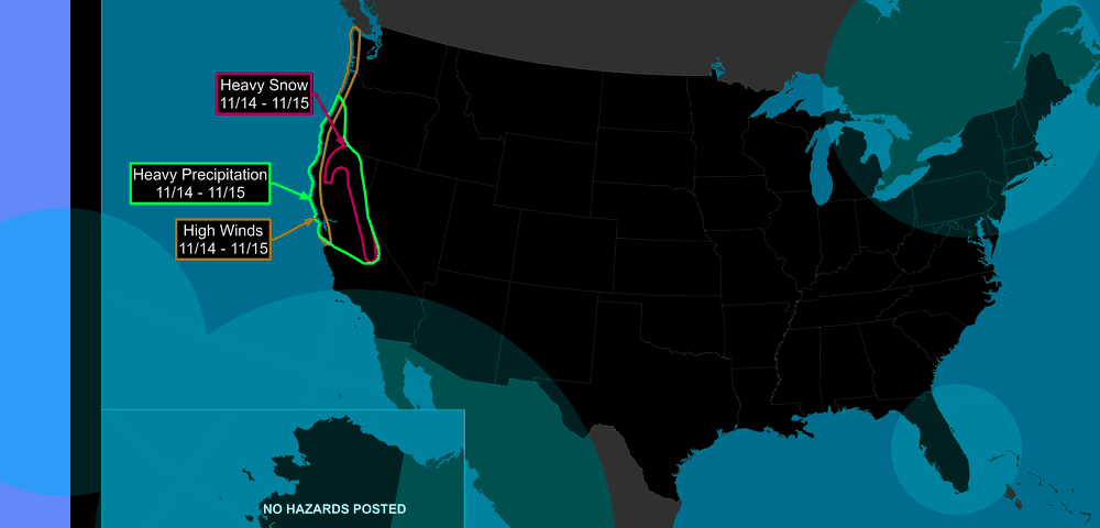
A developing coastal storm could bring heavy rain, strong winds and possible snow to parts of the northeastern United States later this week, according to the National Weather Service (NWS). Pennsylvania and New York are among the areas being monitored as colder air moves into the region.
The weather system is expected to develop over the Ohio Valley by Wednesday, November 11, before moving eastward and potentially strengthening near the Mid-Atlantic coast on Friday.
- A developing coastal storm could affect Pennsylvania, New York and surrounding northeastern states from Thursday, November 12, through Saturday, November 14, bringing rain, gusty winds and possible snow.
- Eastern Pennsylvania could receive up to 2-3 inches of rain, while higher elevations in the Poconos, Catskills and central New York have a greater chance of measurable snowfall.
- The National Weather Service (NWS) says uncertainty remains high over the storm’s track, intensity and snowfall potential. A major regional snowstorm is not currently forecast.
Forecasters expect the greatest risk of widespread precipitation between Thursday and Friday night, although rain and snow showers could persist into Saturday in some locations.
The system’s eventual track will determine which areas receive heavy rain, a rain-snow mix or accumulating snow.
Northeast US storm forecast: Rain, snow and strong winds
The National Weather Service is monitoring a low-pressure system that could develop into a coastal storm as it approaches the Atlantic coast.
Forecast models continue to differ on the storm’s exact path and intensity. A relatively small shift in its track could significantly change precipitation amounts and the geographic distribution of snow.
Eastern Pennsylvania could receive as much as 2-3 inches of rain if the system develops as projected.
New York and surrounding northeastern states could also experience widespread precipitation, with gusty winds possible in coastal and inland areas. However, meteorologists caution that the available forecasts do not support predictions of a major regional snowstorm.
NWS office in Mount Holly, New Jersey, noted rain remains the more likely outcome for much of eastern Pennsylvania, although some snow is possible.
Higher elevations have the greatest chance of accumulating snow because temperatures are more likely to remain sufficiently cold.
Pennsylvania weather forecast: Up to 3 inches of rain possible
Eastern Pennsylvania is among the areas most likely to experience precipitation from the developing coastal system.
The Lehigh Valley, Berks County and Philadelphia region could see rain beginning Thursday and continuing into Friday night.
According to the Weather Prediction Center, much of eastern Pennsylvania has approximately a 10% probability of receiving at least 1 inch of snow between Thursday and Saturday evening.
The probability is slightly higher in northeastern Pennsylvania, particularly across the Pocono Mountains.
Snowfall remains uncertain at lower elevations, where temperatures may favor rain throughout much of the event. If the system strengthens near the Mid-Atlantic coast, rainfall totals could reach 2-3 inches in some locations.
Colder-than-average temperatures are expected to move into the region after the storm passes.
New York weather forecast: Where could snow accumulate?
Parts of New York could experience their first more substantial period of wintry weather as colder air reaches the state later this week.
The NWS office in Binghamton is monitoring a system that could move into the Ohio Valley on Wednesday and Thursday before contributing to the development of a coastal low by Friday.
Current forecasts indicate chances of rain and snow on Thursday and Friday, with additional showers possible into Saturday.
The greatest potential for measurable snowfall is across higher elevations of central and eastern New York.
Areas being monitored include:
- Catskill Mountains: Higher elevations could receive accumulating snow if colder air becomes established.
- Central New York: Rain and snow are possible Thursday and Friday, depending on the storm’s track.
- Western New York: Colder conditions could support some lake-effect rain or snow showers late in the week.
- New York City and coastal communities: Rain is currently more likely than significant snowfall.
Forecasters have not established reliable snowfall totals because the storm’s track remains uncertain. A more southerly coastal track could allow colder air to spread across inland areas, increasing the potential for snow.
Conversely, a track closer to the coast could bring warmer air farther inland, favoring rain.
Western and central New York could see different conditions
Western New York is expected to experience unsettled weather early in the week, with lake-enhanced rain showers continuing into Monday.
The NWS office in Buffalo expects temperatures to remain warm enough for precipitation to fall primarily as rain during this initial period. Colder air is forecast to arrive later in the week, potentially creating conditions favorable for lake-effect precipitation.
However, current forecasts do not indicate a significant lake-effect snow event.
Central New York faces a different scenario, with the developing coastal storm potentially bringing a combination of rain and snow.
The Binghamton forecast office expects precipitation chances to increase Thursday and Friday, particularly if a low-pressure system strengthens along the Mid-Atlantic coast.
Higher elevations would be favored for measurable snowfall, while valleys and lower terrain could experience mostly rain.
When will the Northeast coastal storm arrive?
The potential weather event is expected to develop over several days.
| Date | Expected weather development |
|---|---|
| November 9-10 | Generally mild conditions across much of the Northeast, with scattered showers in parts of New York |
| November 11 | Low-pressure system could develop over the Ohio Valley |
| November 12 | Rain and possible snow begin affecting parts of Pennsylvania and New York |
| November 13 | Coastal system could strengthen, bringing widespread precipitation and gusty winds |
| November 14 | Lingering rain or snow showers possible as the system moves away |
| November 15 | Colder-than-average temperatures expected across affected areas |
The timing could change as forecast models provide a clearer picture of the developing system.
Will the Northeast face a major snowstorm?
The National Weather Service has not forecast a major snowstorm across the northeastern United States.
Although some higher-elevation locations could receive measurable snow, rain remains the more likely precipitation type across much of eastern Pennsylvania, lower elevations of New York and coastal communities.
Forecast uncertainty is particularly high because the developing system has not yet established a definitive track. Meteorologists will continue monitoring the storm’s movement, available cold air and potential coastal intensification.
The NWS typically provides more detailed snowfall projections within 72 hours of a potential winter weather event.
For now, the principal concerns are the possibility of substantial rainfall, gusty winds and localized snowfall at higher elevations, followed by a colder weather pattern across the Northeast.