AccuWeather forecasts an above-average 2026 hurricane season across the Eastern and Central Pacific, with elevated risks for Hawaii, Southern California, Mexico, and parts of Central America.
Forecasters point to unusually warm ocean temperatures and developing El Niño conditions as the main drivers behind the outlook.
The Eastern Pacific basin is expected to produce between 17 and 22 named storms this year, including nine to 13 hurricanes and four to eight major hurricanes. AccuWeather also expects six to nine direct storm impacts across Mexico and Central America.
In the Central Pacific, forecasters project four to seven named storms, including two to four hurricanes and one to three major hurricanes. Hawaii faces one of the higher-risk outlooks in recent years, with forecasts calling for one to two direct tropical impacts.
The state could see damaging winds, storm surge, and heavy flooding rainfall if storm tracks shift closer toward the islands during peak season activity.
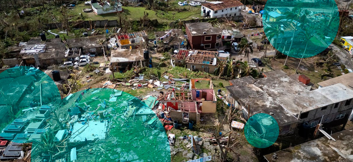
According to Beinsure analysts, warmer ocean surface temperatures continue increasing concern across insurance and catastrophe modeling markets because tropical systems intensify faster over hotter water while maintaining strength longer near coastal regions.
AccuWeather says El Niño conditions are already influencing atmospheric patterns across the Pacific. El Niño events usually reduce wind shear in the Eastern Pacific basin, allowing tropical systems to organize more efficiently and strengthen more rapidly.
To increase resilience, both adaptation and mitigation are needed in Latin America as insurance alone cannot help protect the region from disruption caused by severe weather events brought by El Niño and La Niña, which will also test the long-standing protection gaps, according to Swiss Re Institute report.
A rare event is expected to occur this year: a swift transition from a strong El Niño to La Niña weather conditions.
Weather projections suggest a return to El Niño-Southern Oscillation (ENSO) neutral conditions – starting in May – and also a more than 80% chance of swift transition to La Niña in late summer and the fall (see Impact of Climate Change on Insurance Industries).
Ocean heat also raises the probability of rapid intensification events, where storms gain major hurricane strength over relatively short periods.
Forecasters added that the growing likelihood of a super El Niño later in the season could extend tropical activity deeper into autumn, especially during October and November when conditions may remain unusually favorable for storm development.
The Pacific hurricane outlook contrasts with separate forecasts projecting a quieter Atlantic hurricane season this year. Meteorologists say shifting atmospheric conditions tied to El Niño often suppress Atlantic storm formation while increasing activity across the Pacific basin.
Southern California also remains under closer watch this season. Direct hurricane landfalls remain rare there because colder coastal waters usually weaken tropical systems before arrival.
Warmer ocean conditions increase the chance remnants retain more moisture, wind energy, and flooding potential as they move northward.
Mexico faces the highest direct exposure based on projected storm tracks, especially along Pacific coastal regions already vulnerable to flooding, landslides, and infrastructure damage during active hurricane years.