BMS has released a severe weather update indicating that insurance losses have surged past $10 bn and could reach nearly $20 bn by the end of May 2024.
BMS warned the insurance industry to brace for a harsh severe weather season in the U.S.
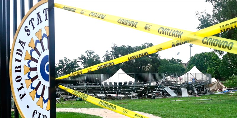
Since April, losses have escalated due to major events, such as severe thunderstorms in Dallas and a derecho in Houston, leaving over 2.07 mn Texans without power (see Severe Thunderstorms the Main Driver for Insured NatCat losses).
The recent events add uncertainty to the loss projections. Based on past occurrences, these events will likely result in several billion dollars in damages.
Following 2023’s record-breaking losses, insurers are implementing changes like higher deductibles and roof-only exclusions. US Severe Weather Insured Losses in Q1 2023 Ranges of $7 bn to $9.5 bn.
However, the impact of these measures on reported losses may take years to fully understand.

Despite these efforts, 2024’s severe weather losses are already 128% above the 10-year average, with 27 loss events reported by the end of May, exceeding last year’s total of 23 events. Typically, the insurance sector sees 18 to 19 events by this time (see Worldwide Tropical Cyclone Season: Listing of Events & Economic Loss).
BMS Insight highlights the persistent severe weather through various metrics, including numerous tornado warnings and severe weather days recorded by the Storm Prediction Center.
In 2024, over 1,919 tornado warnings and 3,142 hail events have been reported, marking one of the most active years for severe weather since 2011.
To address these risks, the insurance industry employs advanced tools and research. The Insurance Institute for Business and Home Safety (IBHS) focuses on improving mitigation of hail and wind damage.

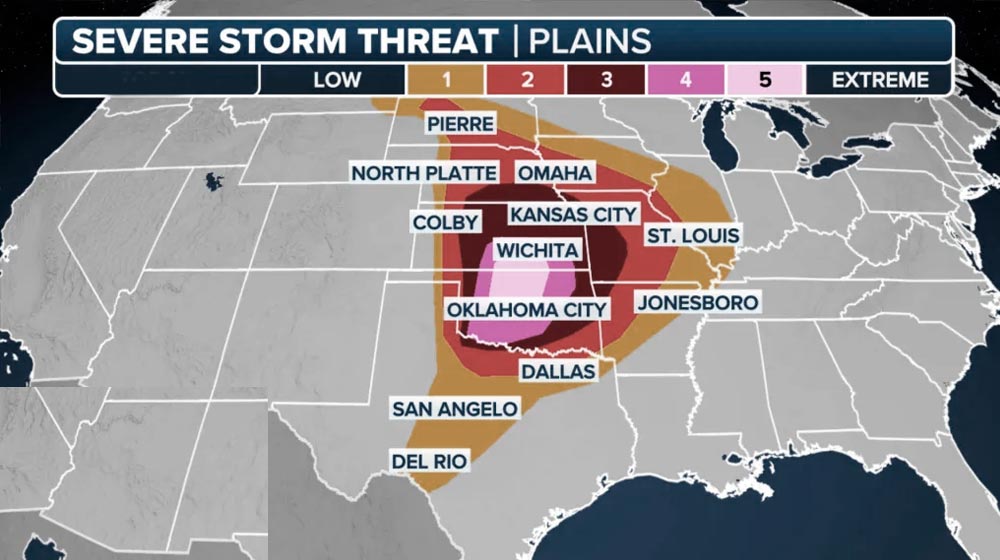
Looking ahead, Siffert predicts potential severe weather in early June, affecting mainly the southern and central plains.
The lessons extend beyond wind damage from tornadoes and straight-line winds. Understanding hails is just as important considering that hail causes 50-80% of the overall severe storm losses to the insurance industry in any given year.
We already talked a bit about hail and the possible underreporting occurring in the observational data. When we have major strings of severe weather, it creates great opportunities for the Insurance Institute for Business and Home Safety hail study program to get out in the field and take observations.
This program has been ongoing since 2012, with the first mission to better understand hailstone properties, like density, size, and distribution.
Now, the program is focused on hail storms, such as understanding the hail swath sizes and comparing them to radar, which will help answer how tight the gradients are of damaging hail.
In doing so, they are actually deploying sensors and small roof sections to gather observations they can take back to the lab to further help in the simulation and recalibration lab testing for different building materials to help the insurance industry limit future losses. BMS is a proud sponsor of the IBHS.
By mid-June, a shift in the weather pattern over North America might occur, reducing the active jet stream.
Thunderstorm development will become regional, driven by daily patterns rather than large-scale ones.
This switch from a trough over the western US to ridging will be less favorable for tornadoes in the Great Plains.
However, it will increase wildfire risks as fine fuels dry out in warmer, drier conditions.
Short Term Severe Weather Forecast
The first week of June is certainly starting to light up for potential severe weather on medium-range guidance. Once again, insurance carriers with exposure are mostly for the southern plains, but even the central plains will continue to feel the impacts of continued severe weather in the short term.
These areas need a break, but it appears some east coast troughing and continued subtle shortwaves coming over the Rockies should push more severe weather further west into the front range and into west Texas.
In fact, a prolonged period of moisture influx from the Gulf may result in multiple days of large convective available potential energy days, which is a large indicator of more severe weather days ahead.
Longer Term Severe Weather Forecast
By the middle of June, there may be a weather pattern shift for North America, which has less of an active jet stream.
The focus of thunderstorm development will be regional and driven by more mesoscale daily patterns and less by synoptically driven patterns. This overall pattern will switch from a trough over the western US to ridging, which is less favorable for tornadoes across the Great Plains.


