Millions of residents from Louisiana to Florida were under hurricane and storm surge warnings Thursday as Hurricane Isaias moved toward the northern US Gulf Coast.
The Category 1 hurricane had sustained winds of 80 mph. Isaias strengthened from a tropical storm, becoming the first hurricane of the 2026 Atlantic hurricane season.
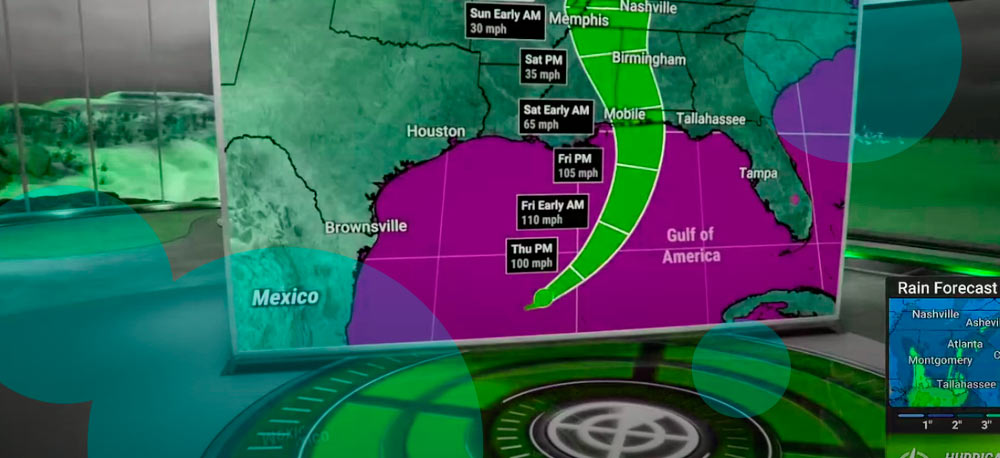
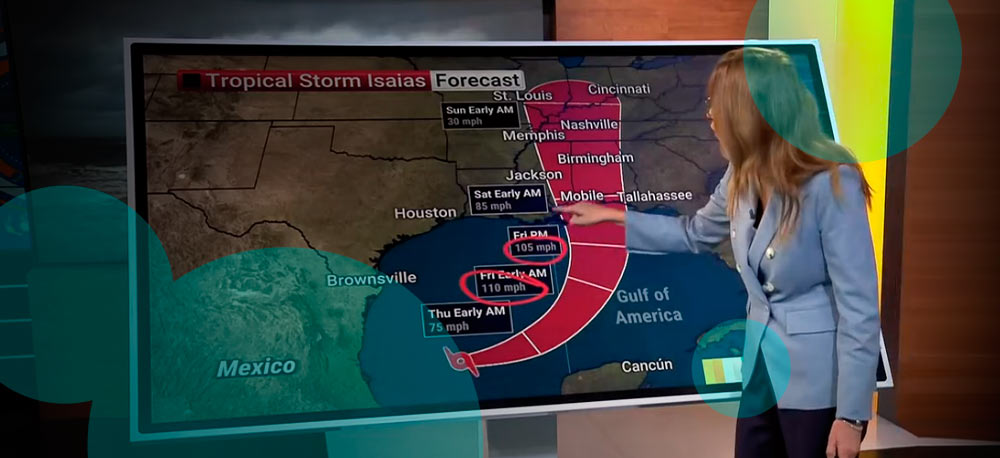
The storm is expected to pass north of Mexico’s Yucatán Peninsula before approaching the northern Gulf Coast. Landfall is forecast for late Friday or early Saturday.
Forecasters expect additional strengthening before Isaias reaches the coast. The National Weather Service said the system is forecast to approach the northern Gulf Coast as a strong hurricane Friday, bringing dangerous storm surge, hurricane-force winds and heavy rainfall.
Storm surge warnings extend from the mouth of the Mississippi River to Steinhatchee, Florida. Residents across the warning zone have been told to follow instructions from local authorities and evacuate when ordered.
Hurricane warnings are in effect from Ocean Springs, Mississippi, east to the Bay and Gulf County line in Florida.
Damaging hurricane-force winds are expected across parts of the Florida Panhandle, southern Alabama and southern Mississippi. Power failures lasting for an extended period are possible where winds damage electricity networks, trees and other infrastructure.
The storm also carries a tornado threat. Isolated tornadoes are possible Friday night across coastal Alabama, the Florida Panhandle and far southwestern Georgia (see Hurricane Tracker).
The risk shifts farther inland Saturday. Eastern Alabama, Georgia and northern Florida are among the areas expected to face another period of possible tornado activity as Isaias moves away from the coast.
States and local governments have started emergency preparations ahead of landfall.
Alabama Gov. Kay Ivey declared a state of emergency Wednesday covering 40 counties. The order allows state authorities to take emergency measures before landfall and remains in effect through Oct. 14.
- Florida Gov. Ron DeSantis declared a state of emergency for 25 counties this week as officials prepared for possible impacts across the Panhandle and Big Bend. The Florida order gives affected communities additional time and resources to prepare for severe weather associated with Isaias.
- Okaloosa County declared a local state of emergency Wednesday and ordered evacuations for some residents in coastal locations. Panama City also issued a local emergency declaration because of the storm’s potential threat to residents and property.
School districts across parts of Florida and Alabama have announced closures before the hurricane reaches the coast.
Transport networks face disruption as well. The Federal Aviation Administration warned Thursday that Isaias could force closures of Gulf air routes as conditions deteriorate.
The National Weather Service office in Morristown, Tennessee, expects the remnants of Isaias to bring heavy rainfall and strong winds into the region during the weekend.
Wind speeds in the eastern Tennessee mountains and foothills could exceed 60–70 mph in some locations. Heavy rain also raises the risk of isolated flash flooding.
The warning area covers hundreds of miles of coastline from Louisiana through the Florida Big Bend. Authorities are urging people in evacuation zones to follow local orders rather than wait for conditions to worsen.
Wind damage is expected across portions of Mississippi, Alabama and Florida as Isaias approaches land. Hurricane-force gusts risk bringing down trees and power lines, leaving some areas without electricity after the storm passes.
Rainfall will continue after the center moves inland. The storm’s circulation is expected to carry tropical moisture through the Southeast over the weekend, extending the flooding threat well beyond the Gulf Coast.
Tennessee is among the states preparing for those inland effects. Mountainous terrain there increases exposure to strong gusts, while repeated heavy rainfall raises concern around streams and flood-prone roads.
Emergency officials across Louisiana, Mississippi, Alabama and Florida are preparing for worsening weather beginning Friday. Evacuation orders have already started in some coastal communities, and further local measures remain possible as the storm approaches.
Isaias is expected to reach the northern Gulf Coast late Friday or early Saturday after strengthening over warm Gulf waters. Its effects will extend well beyond the point of landfall, with storm surge near the coast and flooding, strong winds and tornadoes spreading inland through the weekend.