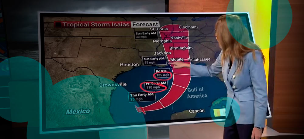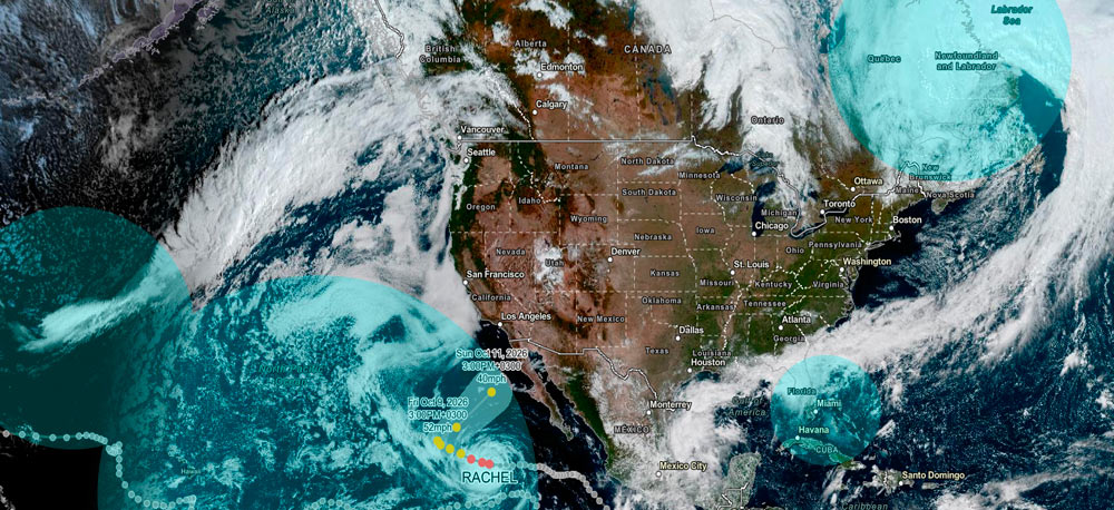
Hurricane Isaias has become the first hurricane of the 2026 Atlantic season as it strengthens over the Gulf of Mexico and heads toward the northern Gulf Coast.
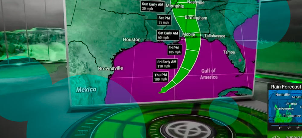
The storm is expected to bring storm surge, heavy rainfall and damaging winds from Louisiana to Florida beginning Friday. Landfall is forecast Friday night or early Saturday, followed by a move inland across the Southeast and eastern United States through the weekend.
Isaias was centered more than 400 miles south-southwest of New Orleans and moving northeast. Forecasters expect it to turn more toward the north as it crosses the central Gulf.
The hurricane is forecast to strengthen to at least Category 2 intensity by Thursday night. Gulf waters remain unusually warm, with sea surface temperatures well into the 80s, while the surrounding air mass contains ample moisture. Flood watch in Florida as heavy rain raises coastal flood threat.
A southward dip in the jet stream is expected to increase wind shear as Isaias approaches the northern Gulf Coast. Strong shear disrupts a hurricane’s circulation and often reduces wind intensity.
Forecasters therefore expect some weakening before landfall. Isaias is most likely to reach the coast as a Category 1 hurricane, though Category 2 strength remains possible.
That reduction in wind speed would do little to remove the broader threat. Storm surge, flooding rain and strong winds remain serious concerns across a long section of the Gulf Coast. Florida has activated emergency measures across 25 counties as Isaias strengthens in the Gulf, with flooding, strong winds and tornado risk ahead.
A storm surge warning stretches from the mouth of the Mississippi River to Steinhatchee, Florida. A storm surge watch extends farther south to Yankeetown (see Hurricane Tracker).
A hurricane warning covers the coast from Ocean Springs, Mississippi, to the Bay and Gulf County line in Florida.
Tropical storm warnings include the Jefferson and Plaquemines Parish line south of New Orleans through areas west of Ocean Springs. They also extend east of the Bay and Gulf County line to Florida’s Aucilla River. Parts of southern Alabama and southeast Mississippi farther inland are included as well.
Storm surge is expected to produce some of the most dangerous coastal conditions. Water pushed inland from the Gulf is expected to flood normally dry ground near and east of the storm’s track. The highest levels depend on the timing of landfall and local tides. Areas experiencing peak surge near high tide face a greater flooding threat.
Wind damage is also expected from extreme southeast Louisiana through southern Mississippi and into the Florida Panhandle.
Strong winds are forecast to reach portions of the coast around midday Friday and continue through at least Saturday morning. Trees and power lines are at risk of falling, and some communities face power outages lasting from several hours to multiple days.
Heavy rain is expected to begin along the Gulf Coast Friday before moving inland during the weekend. Most locations near the coast are forecast to receive 3–7 inches, with isolated totals around 10 inches. Those amounts raise the risk of flash flooding, especially where rainfall becomes concentrated over a short period.
The flood threat will then shift inland across much of the Southeast. Parts of the Appalachians, Ohio Valley and mid-Atlantic also face heavy rain as the weakening circulation moves north.
Tornadoes are another concern near and east of the track. Outer rainbands associated with landfalling hurricanes sometimes produce brief tornadoes. That risk begins Friday as Isaias approaches the coast and remains present Saturday across parts of the Southeast.
The zone from New Orleans east toward Tallahassee faces some of the heaviest rain and strongest winds. Central Florida and southeast Georgia are also expected to receive substantial rainfall.
By Saturday, Isaias is expected to have moved inland and weakened from hurricane strength. Its weather effects will continue across a much larger area.
Heavy rain and strong winds are forecast across parts of Mississippi, Tennessee, Alabama, Georgia, Florida and the Carolinas. Jackson, Memphis, Nashville, Atlanta, Wilmington, Charleston, Tallahassee and Orlando are among the cities in the broader impact zone.
By Sunday, the remnants of Isaias are expected to move farther north.
Rain will spread toward the Great Lakes and Northeast while continuing across parts of the Southeast. Cities including Charlotte, Virginia Beach, Washington, New York City, Philadelphia and Baltimore are within the projected rainfall corridor.
Cincinnati and Detroit also sit within areas where rain from the system is expected.
The main coastal threat remains concentrated from southeast Louisiana through the Florida Panhandle. Residents there face a combination of storm surge, damaging winds and flooding rain during Friday and Saturday.
Emergency preparations are being urged before conditions worsen. Coastal residents are being advised to follow evacuation instructions from local authorities and know whether their homes are inside designated surge zones.
Flash flooding is expected to become the main concern as Isaias moves through the Southeast and toward the Appalachians, Ohio Valley and mid-Atlantic.
The storm’s exact strength at landfall remains sensitive to wind shear over the northern Gulf. Its expected path places a broad section of the Gulf Coast on the wetter and windier side of the circulation.
Even if Isaias weakens shortly before reaching land, its storm surge and rainfall threats will remain in place. The system then carries that flood risk inland through the weekend as its circulation accelerates north.