Karen Clark & Company estimates privately insured losses from Hurricane Debby in the US to reach approximately $1.4 bn, based on the high-resolution KCC US Hurricane Reference Model.
Wind damage accounts for $845 mn, storm surge for $130 mn, and inland flooding for $440 mn.
This estimate covers privately insured damage to residential, commercial, and industrial properties, automobiles, and business interruptions. It excludes boats, offshore properties, and NFIP losses.
Hurricane Debby Highlights
- Hurricane Debby made two landfalls: first on August 5 as a Category 1 hurricane with 80 mph winds in Florida’s Big Bend region, and again on August 8 as a tropical storm with 50 mph winds in South Carolina.
- The storm brought heavy rain to the eastern US, with the highest rainfall reaching 18.16 inches near Parrish, FL, and totals exceeding 14 inches in Georgia and the Carolinas.
- An upper-level ridge over the western US created weak upper-level winds, causing Debby to move slowly over the southeastern US. The lack of steering currents led to its erratic track off the coast of South Carolina.
- Debby was the third hurricane in the last decade to make landfall in Florida’s rarely impacted Big Bend region, following Hermine in 2016 and Idalia in 2023.
Hurricane Debby originated from a tropical wave west of the Antilles, becoming a tropical depression after crossing Cuba on August 3. It intensified into Tropical Storm Debby the same day in the Gulf of Mexico and later strengthened into a Category 1 hurricane on August 4.
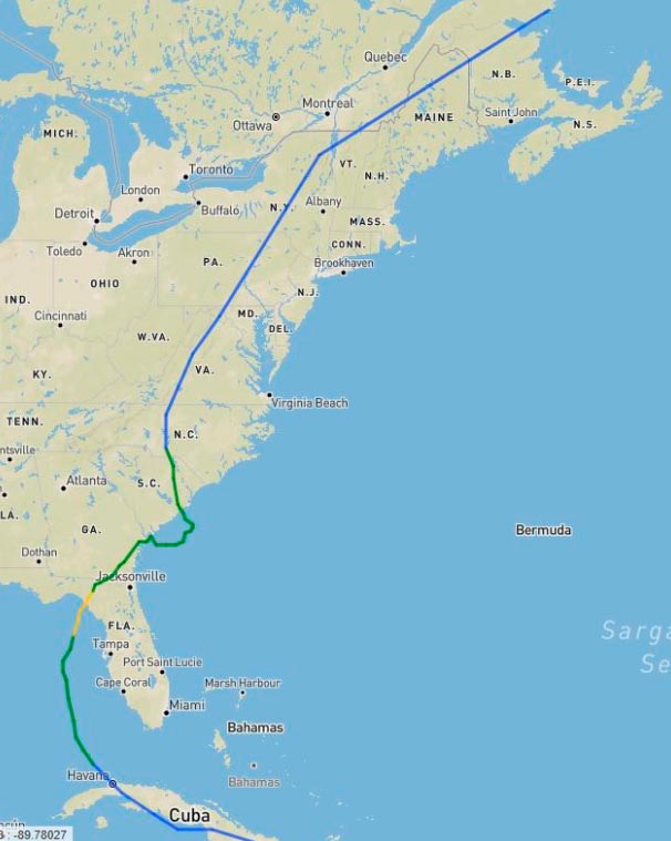
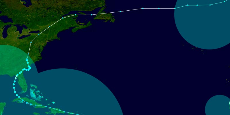
Hurricane Debby Track

Debby turned northeast due to a trough over the US, making landfall in Florida’s Big Bend near Steinhatchee on August 5 with 80 mph winds.
The storm weakened to a tropical storm shortly after moving inland. Upon reentering the Atlantic near the Georgia-South Carolina border, Debby’s forward motion slowed, and it shifted northwest, making a second landfall near Bulls Bay, SC, as a tropical storm with 50 mph winds on August 8. The storm weakened to a tropical depression and became post-tropical the following day while moving north-northeast through the eastern US.
Debby moved slowly along the eastern US, causing significant damage from wind, storm surge, and inland flooding. The storm’s initial landfall in a sparsely populated area of Florida limited wind damage as it weakened quickly after moving inland.
Storm surge reached 6 feet in Cedar Key, FL, and 4 feet in parts of Tampa Bay, leading to minor coastal flooding in Crystal River and Horseshoe Beach. Debby’s second landfall in South Carolina resulted in a storm surge of 1 to 2 feet.
Debby’s slow movement caused heavy rainfall, leading to widespread inland flooding along the East Coast. Some areas in Florida, Georgia, and the Carolinas saw over a foot of rain. As the storm progressed north, several inches of rain fell from Virginia to Maine.

 by
by 


