Moody’s RMS estimates total insured losses from the moment magnitude Mw7.5 earthquake that struck the Noto Peninsula, Japan, on Monday, January 1 are likely to fall within the range of JPY ¥ 435 billion to JPY ¥ 870 billion (US$3 billion to US$6 billion).
The industry loss estimate is based on an analysis of the earthquake using Moody’s RMS Japan Earthquake and Tsunami high-definition (HD) Model and reflects property damage, contents, and business interruption across residential, commercial, and industrial lines and includes both private and mutual (Kyosai) markets.
The estimate includes losses from strong ground shaking, earthquake-induced fires, tsunami inundation, land sliding, and liquefaction-induced ground deformation, and also considers sources of post-event loss amplification (PLA), and inflationary trends. It does not include losses to non-modeled exposures such as transport and utility infrastructure, government, or automobile lines.

On Monday, January 1, an earthquake of moment magnitude Mw7.5 struck the Noto Peninsula around 26 miles (42 kilometers) northeast of Anamizu, a town in Ishikawa Prefecture, Japan, at a depth of 6.2 miles (10 kilometers), according to the United States Geological Survey (USGS).
The Japan Meteorological Agency (JMA) uses its Seismic Intensity Scale to categorize the intensity of local ground shaking on a scale from zero to a maximum of seven.
The JMA reported a moment magnitude of Mw7.6 and a maximum seismic intensity of seven on the JMA Seismic Intensity Scale in the Shika Town Municipality, Ishikawa Prefecture; a seismic intensity of upper and lower six was observed elsewhere in Ishikawa Prefecture.
According to the USGS, the earthquake occurred because of shallow reverse faulting on the west coast of Japan where crustal deformation created by broader plate motions is accommodated in shallow crustal faults.
Focal mechanism solutions for the earthquake indicate faulting occurred on a moderately dipping reverse fault striking from southwest to northeast and dipping to the southeast.
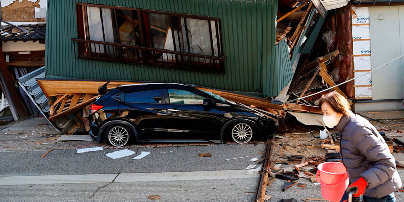
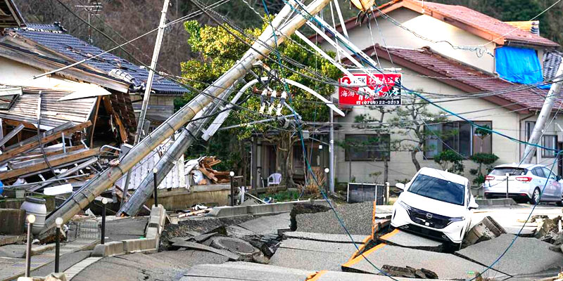
The earthquake was felt widely across Ishikawa, Toyama, and Niigata Prefectures. Official assessments from Japan’s Fire and Disaster Management Agency (FDMA) are ongoing, as of January 11 over 3,500 properties are reported as damaged, a number that is expected to rise significantly as these damage assessments continue, particularly in the worst affected areas on the Noto Peninsula.
The earthquake generated a localized tsunami that impacted the west coast of Japan. The cities of Noto and Suzu were the worst impacted, where tsunami inundation damage was reported. A maximum tsunami wave height of 1.2 meters (3.9 feet) was recorded near Wajima, Ishikawa Prefecture.
A large fire broke out following the earthquake in a residential area in Wajima, which reportedly destroyed around 200 shops and houses in the tourist area of Asaichi Street.
Chesley Williams, Senior Director, Moody’s RMS, concluded: “This event highlights the importance of evaluating shallow crustal earthquakes within a comprehensive view of seismic risk – in Japan and around the world. While the seismic risk in Japan is driven by subduction zone events, there have been several damaging shallow crustal events in recent decades including the 1995 Great Hanshin Earthquake, the 2016 Kumamoto Earthquakes, and now the 2024 Noto Peninsula Earthquake.”


